Discover the Sierra Helada Natural Park
Discover the Sierra Helada Natural Park
One of the many attractions of the Valencian Community is the Sierra Helada Natural Park. This maritime environment, with cliffs and the Mediterranean Sea in the background, offers various alternative routes for your exploration. We will give you three different options so you can enjoy spectacular views to the fullest. Don’t miss them!
The Routes of Sierra Helada Natural Park
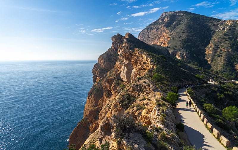
The Sierra Helada Natural Park was designated as a Natural Park of the Valencian Community in 2005. It is very popular among hikers seeking to enjoy fascinating views of the Mediterranean from the top of the cliffs. The area, covering more than 5,600 hectares, runs along paths more than 300 meters high from where you can see coves and at least two of the nearby islands to Benidorm.
Each of the three routes we show you has different characteristics and levels of difficulty. You can see the details of each and evaluate which one best suits your circumstances. Keep in mind that they run along paths very close to the cliffs, so you must exercise caution, especially if you are with children.
Punta del Cavall Route
• Difficulty level: Easy.
• Distance: 5.2 km.
• Duration: 1 hour 10 minutes in motion.
This is one of the easiest options for a family route, not demanding, but with outstanding results. It’s perfect if you’re spending a vacation in the city of skyscrapers, Benidorm, or in one of its nearby municipalities, such as Calpe, Benissa, or Altea.
Our route begins at the end of Avenida de Madrid, in Benidorm.
The path follows the coast, leaving the city behind and passing near Cala Almadrava, a beautiful rocky and sandy beach with crystal-clear waters. Further ahead, you reach the entrance of the Natural Park, clearly indicated by a sign. You’ll know you’ve arrived by the chains blocking vehicle access. Very close is also Cala del Tío Ximo, another point of interest.
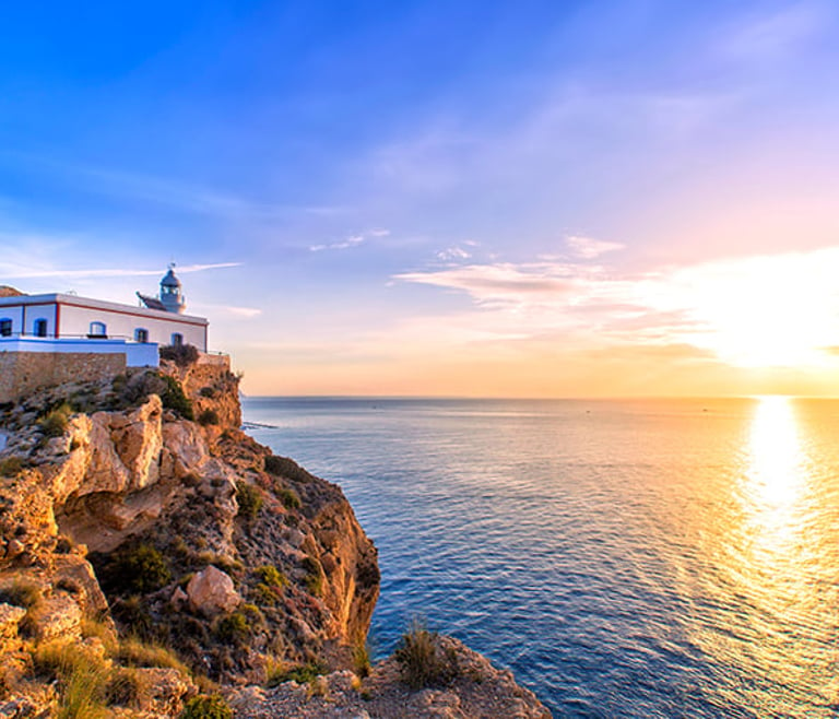
From there, just follow the trail until you reach the next and final point of interest, Punta del Cavall, also known as the viewpoint of Sierra Gelada Natural Park. Additionally, you will see the 17th-century Watchtower, a perfect place for photographs.
Faro del Albir
• Difficulty level: Easy.
• Distance: 4.8 km.
• Duration: 1 hour 10 minutes in motion.
This route starts in Albir. It is a versatile trail that you can walk, run, or bike. You can also go with young children. The Albir Information Point is the starting location, although the route itself begins a little further along. There is a seating area next to a pine forest along the way.
Further ahead, there is a yellow sign indicating the way forward. It’s important to pay attention to the signage to avoid taking the wrong trail. Later, you will reach the first noteworthy points, a series of viewpoints from which you can see the beaches of Albir or Altea. You can also spot Calpe in the distance, with its famous Penyon de Ifach. Along the route, there are benches to sit and enjoy the rest and the views.
If you’re not in a hurry, you can take some side paths to bathe in one of the nearby coves, such as Caleta del Metge or Cala La Mina. If you stand with your back to the sea, you will see some natural perforations in the rock walls, with the Whale Cave, or Boca de la Balena, being the most striking due to its size.
Following the Cantera Path, you will see a detour to access one of the old entrances to ocher mines, used as a textile dye. You can take it or continue towards the lighthouse, the final destination of the route, where you can see an exhibition about the area.
Sierra Helada Route
• Difficulty level: Medium – hard.
• Distance: 11 km (one way).
• Duration: 5 hours in motion.
The entire Sierra Helada Natural Park route covers the entire cliffs. It begins at the end of Avenida de Madrid in Benidorm. After passing Buenos Aires Apartments, you need to turn left onto the street Dos Calas. Up the hill, you will see a junction. Turn right and reach the Cruz de Benidorm road. Follow it, and when you arrive there, continue towards the antennas.
From there, follow the trail that runs along the edge of the cliffs. You will arrive at Alto del Gobernador, the highest point of the Sierra (440 meters). Continue towards Faro del Albir, the route’s final point. During the journey, you will see the Mitjana island up close. You will also get unique views of Benidorm island, Albir, Calpe, and its Penyon.
As you can see, tourism in the Levante offers many recreational activities. Villas Guzmán offers accommodations to enjoy the unique places of the Mediterranean coast. Use our search engine to choose the best option for your vacation.