Montgó Natural Park
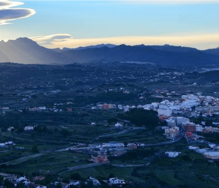
Located between Jávea and Denia, Montgó Natural Park is one of the most important natural attractions of the Costa Blanca. This park is a must-see for nature lovers. With 753 meters of height and bathed at its feet by the crystalline waters of the Mediterranean, Montgó Natural Park offers visitors privileged views of the Costa Blanca, and even Ibiza island, if the weather permits. A total of 2,117 hectares inhabited by up to 650 species of fauna and vegetation, mainly including holm oaks, pine forests, ermines, rabbits, Eurasian owls, badgers, wild boars, and foxes. Montgó offers visitors 3 sedentary routes with different levels of difficulty.
Green Route: Les Planes
This route has a distance of 4.5 km with an estimated duration of one and a half hours. Suitable for cycling.
The route starts at the recreational area, located 700 meters before reaching the lighthouse at Cabo de San Antonio. Here we will visit the old carabineros barracks, the Santuario de la "Mare de Deu dels Angels", and the ascent of the mills, a group of windmill towers (the oldest dating back to the 14th century). We will return to the starting point along the slope of Cabo San Antonio.
Yellow Route: La Cova de l'Aigua and Racó del Bou
As it is a medium difficulty route, its distance is 3.5 km with an approximate duration of three and a half hours. Unlike the previous one, this route is not suitable for cyclists.
The route begins at the hermitage built in the 1980s, next to the Pare Pere cabin (17th century), a curious shelter where the famous Denia character used to pray. The path snakes through the now abandoned agricultural colony of Montgó Natural Park, which in the first third of the 20th century was dedicated to the production of muscatel grapes.
As we ascend, the landscape becomes more impressive, and we will be able to see with the naked eye, the entire Valencia Gulf, the mountains of La Safor, Cullera, the Mediterranean Sea and, on clear days, Ibiza Island on the horizon to the east. We will arrive at La Cova de l'Aigua, where we will find an inscription dating back to 238 BC.
Finally, we will gradually descend to Racó del Bou or l'ull de Bou, just before returning to the starting point.


