Benitatxell Cliffs Route
Benitatxell Cliffs Route
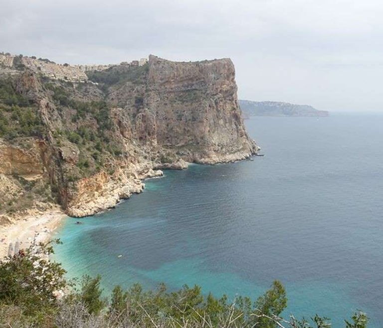
Located in the Province of Alicante, in the comarca of la Marina Alta, Valencian Community, we find the municipality of Benitatxell. It features two spectacular kilometers of coast along the rugged Mediterranean Sea. An ideal space for exercise and recreation.
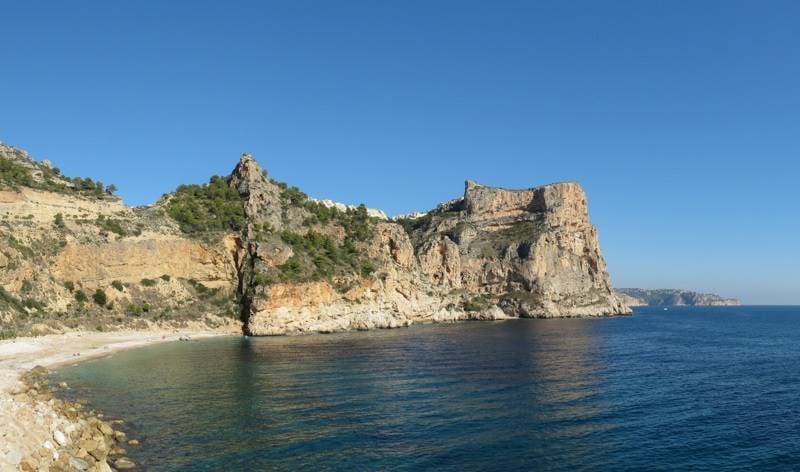
It is a wild and rugged coast, filled with cliffs that can reach up to 100 meters above sea level. Multiple caves, coves, and trails make up what is known as the Ruta de los Acantilados de Benitatxell. We tell you the details.
Hiking along the Cliffs from Benitatxell to Moraira
The Ruta de los Acantilados de Benitatxell has an estimated length of 4 kilometers, round trip. The duration depends on how much time you want to dedicate to each cove or cave you encounter along the way. If you are an experienced athlete, it may only take a couple of hours. It is not a route suitable for all visitors, so a guided tour is recommended the first time.
The journey starts at the well-known Cala Moraig, a beautiful and wide bay, bathed by a sea of crystal-clear, calm waters, with shades ranging between blue and emerald. The route ends at Cala Llebeig, small, remote, hidden, but offering a rewarding sight and feeling.
From Cala Moraig
Perhaps the hardest decision is to look away and stop enjoying the embrace of this beautiful bay to immerse yourself in the slippery path that begins the cliff trail. The trail follows the projection of the cliff.
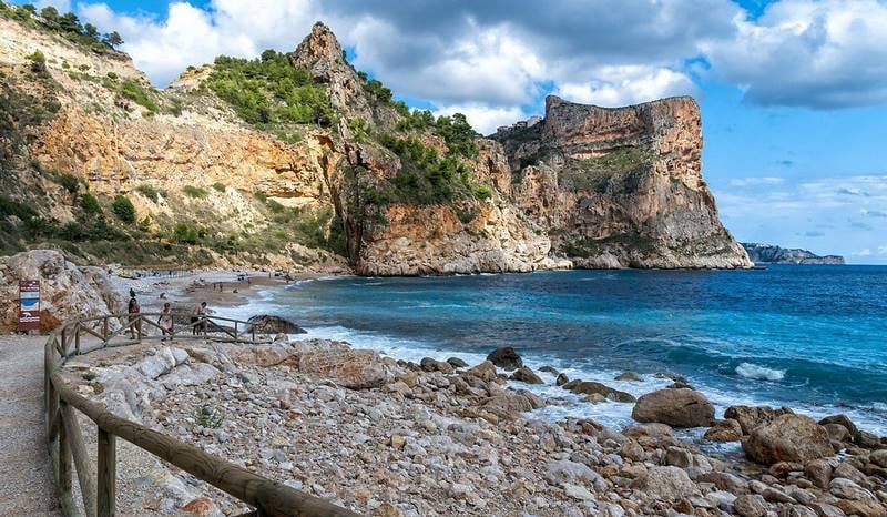
Along the route, you will see stairs built over rocks that lead to artificial caves, constructed as shelters from the sun or rain and initially used by smugglers, fishermen, or local farmers. You can see the remains of the Cova de les Morretes and visit the Cova Domingo l'Aviar on the way to Cala Llebeig.
Following the Cliff Trail
Venturing onto the trail allows you to pass by the Cueva de Pepet del Morre and visit the Ruins of the Cova de Toni el Senyalat, before descending toward Punta de l'Aldera, just before Cala Llebeig. It is an uneven path that descends from over 100 meters down to about 40 meters above sea level.
Towards Cala Llebeig
This is perhaps the most delicate section of the route. After passing the Cueva del Morro del Bou, you may find the trail where the descent to the beach begins. Due to its characteristics, it is a slippery route that can be dangerous. Some fishermen’s houses and colorful boats adorn the marine scene.
Essential Recommendations
- Plan your route and avoid the harsh summer sun and midday hours. It is important to choose the best time for the hike.
- Wear appropriate footwear.
- Take your time and enjoy the scenery.
- Bring enough water and snacks to recharge your energy.